This time a very special event draws me to the Wachau: the apricot blossom. Due to the warm winter, it has come a little earlier this year. Normally, the apricot trees don’t blossom until two weeks later, at the end of March and beginning of April. I saved this section of the Jauerling circuit especially for this, as most of the apricot gardens in the Wachau are located between Spitz and Willendorf.
On the opposite bank, in Hofarnsdorf, are also several gardens, which are also clearly visible from the high points of the route. The stage would certainly have been very picturesque in autumn, but the blossom only comes once a year and only for a short time. After around 10 days, the flowers will have already faded.
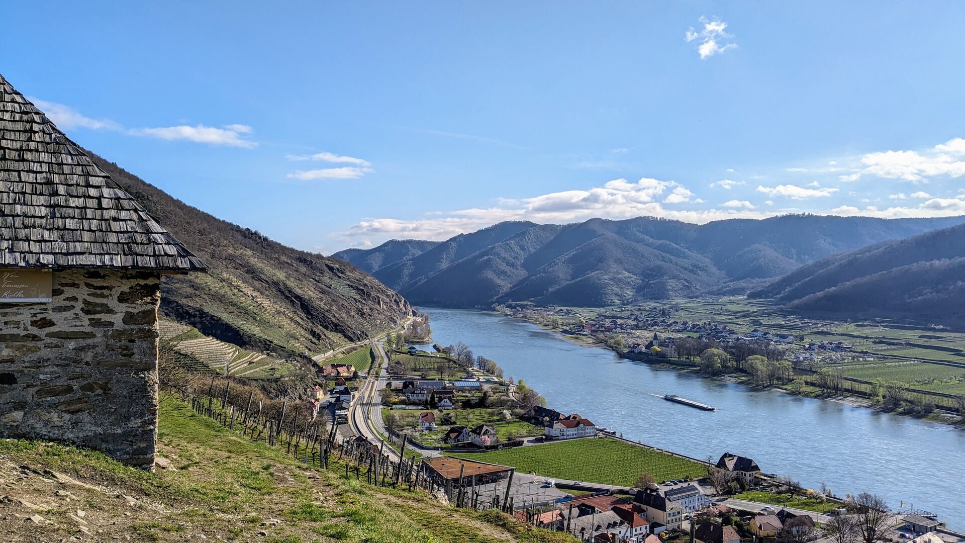
At the Tausendeimerberg
I set off from Spitz early in the morning to avoid the onslaught of flower-watchers in the afternoon. It still feels really fresh in my running shorts. A brisk wind also cools me down, but I wrap up my windbreaker on the first climb up the Tausendeimerberg. The sun is already shining splendidly and should soon warm up the land considerably.

The official route for the Jauerling circuit does not include the Tausendeimerberg. However, the extra 80 metres in altitude are worth it. After overcoming a steep trail, I have a wonderful view over Spitz, to Hofarnsdorf, to the ruin Hinterhof and into the Spitzer Graben.
A few benches and a vending machine filled with wine invite you to rest and to enjoy the view with a glass of wine. In autumn, just before the grape harvest, the panorama will be certainly even more impressive when all the vines are bearing grapes. The hill’s peculiar name is derived from the abundance of wine that grows on it. It is said to have supplied 1000 buckets of Riesling to the lordship of Spitz. I then descend via a tarmac path to the Spitz cemetery. The first and smallest hill of my hike is now over.
 />
/>
 />
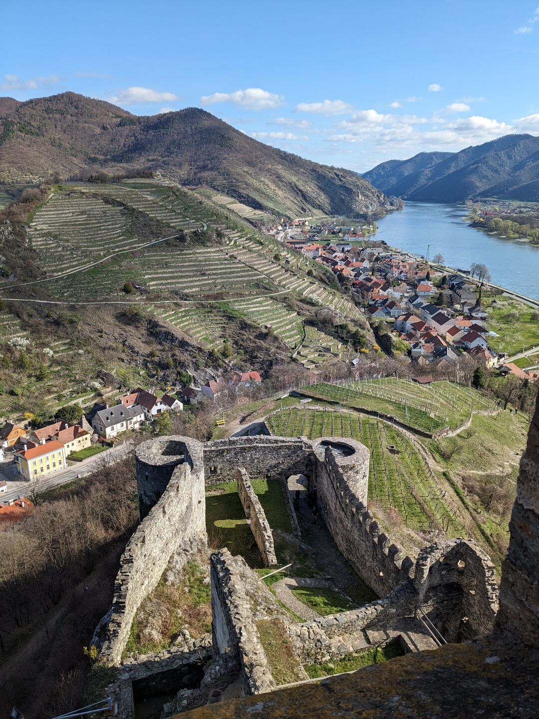
/>Ruin Hinterhaus
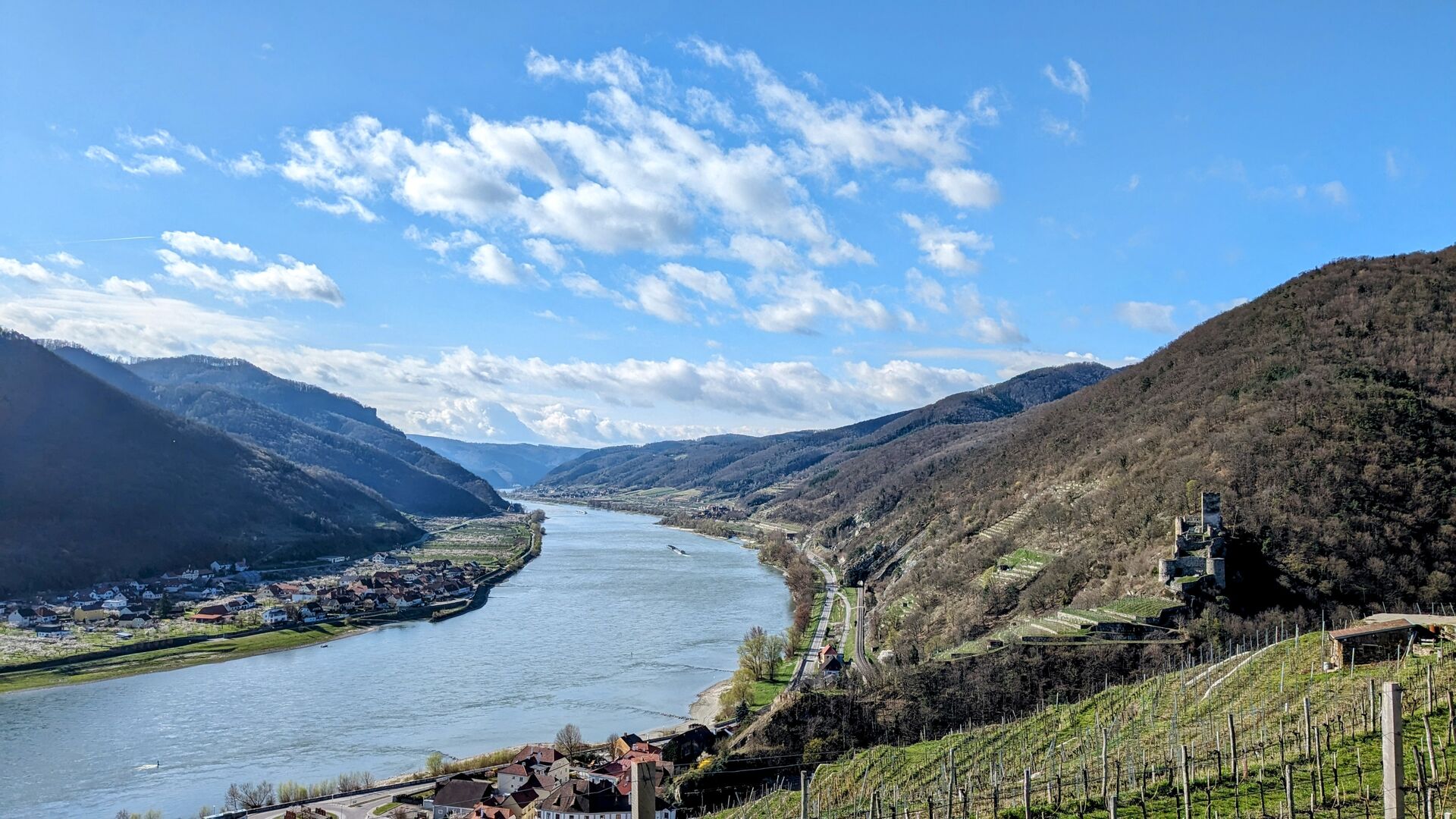
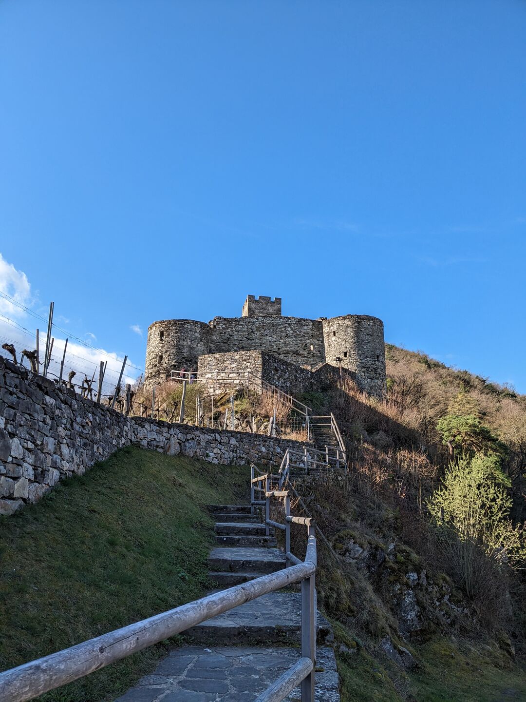
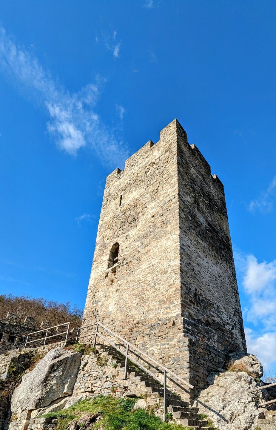
After a short downhill section, I cross the Spitzer Bach stream just before the railway underpass. The route then climbs steeply uphill to the castle through a mixed deciduous forest. I take a short rest and photo break at a romantic pavilion, vulgo Lusthaus, which offers a great view over the Danube valley. However, a panoramic break is not absolutely necessary, as the Ruin Hinterhaus, which follow soon afterwards, grants a far more extensive panorama. The pavilion would be a fantastic place for a wine picnic in the morning though.
The woodland ends just after the pavilion and sparse vines provide a view of ruin. A few more steps and I’m standing in front of the gate of the old fortress. Fortunately, there are no longer any grim, armed guards here, only a voluntary donation for the preservation of it can be paid on entry.
The foundations of the castle were laid in the 13th century, and it was also used for military purposes until the 16th century. It is definitely worth a visit. The ruin is beautifully maintained but is overshadowed by the ruin Dürnstein and Aggstein, which is why it is less frequently visited. At the top of the castle keep, which is also accessible, I once again enjoy the panoramic view over the Danube valley and Spitz before returning to the hiking trail, this time quickly and without any long interruptions to Schwallendorf.
 />
/>
 />
/>
 />
/>A brisk run in the forest
Shortly after the ruin, the path climbs again. It is not easy to find. Last year’s autumn leaves form a uniform brown surface and make it difficult for me to run quickly. I move forward cautiously, with no visibility on the ground. However, the leaves shouldn’t be a problem for walking.
The winter storms have also taken their toll on the mixed deciduous forest. I hop and climb over several fallen trees. Twice I almost lose the path. Forestry work has made deep furrows in the forest floor and destroyed the path. Then it gets steep and slippery down to Schwallenbach. With all the leaves, you have to be careful not to fall on your bottom too often. In early autumn or late summer, the leaves should cause fewer problems.
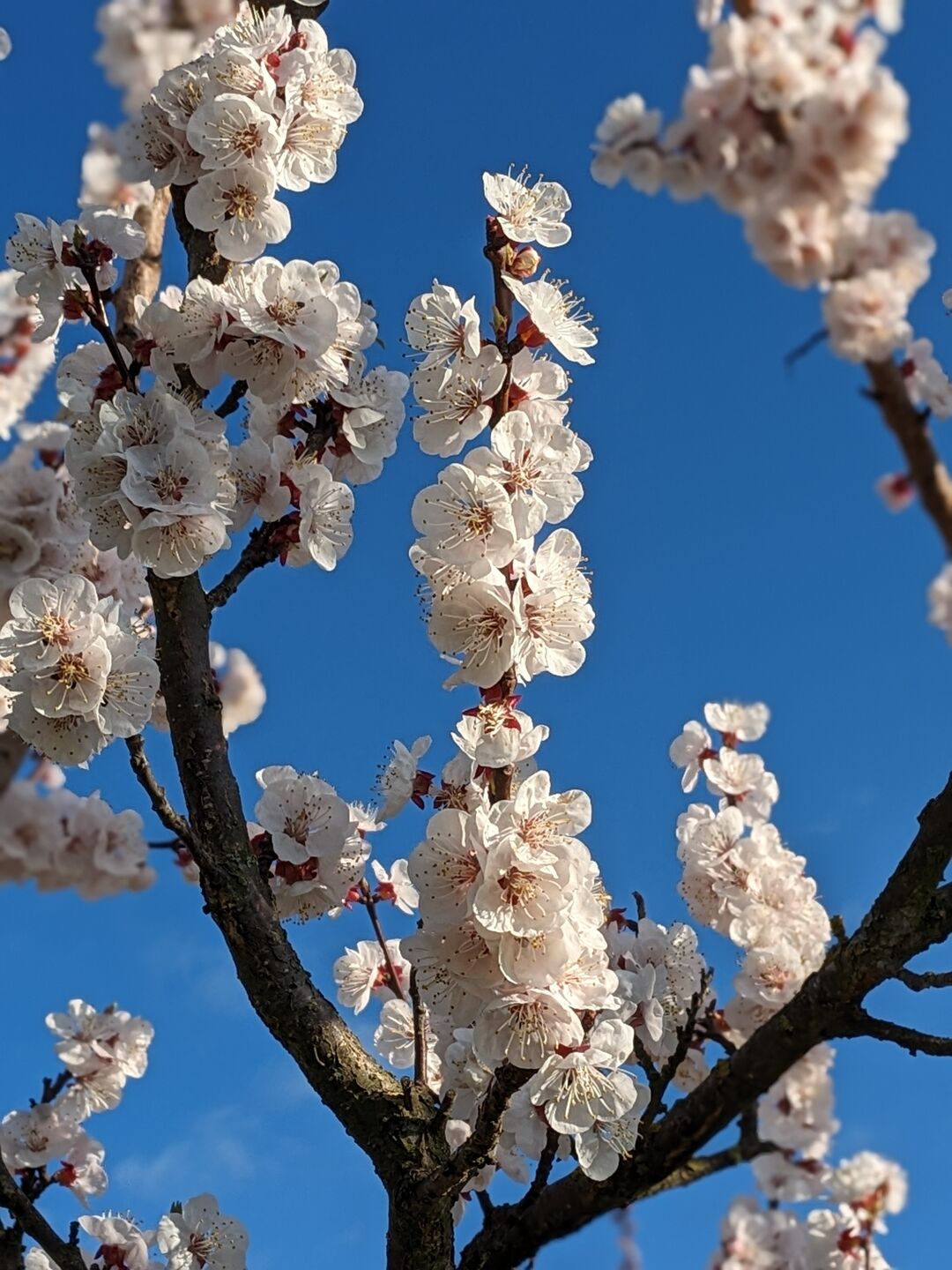
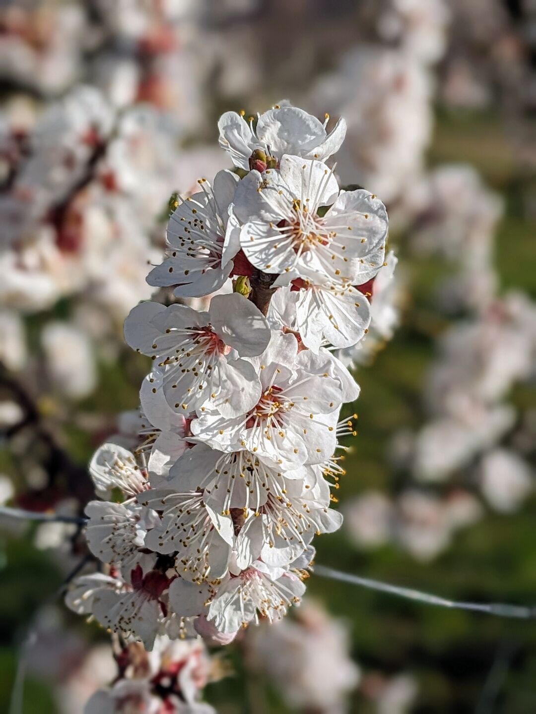
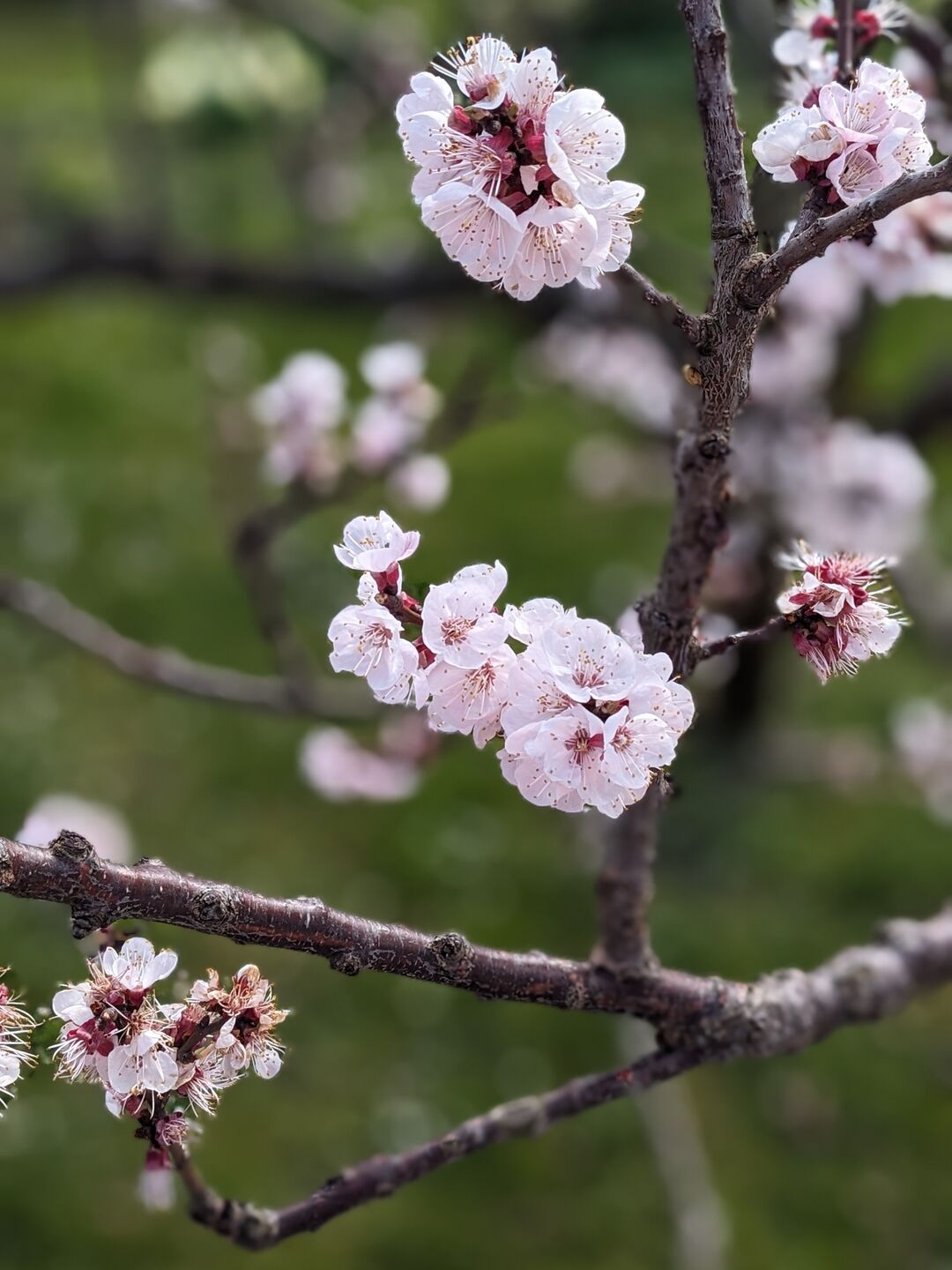
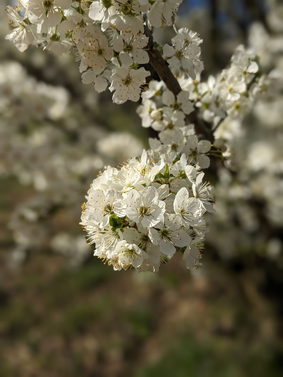
Apricot blossom between Schwallenbach and Willendorf
I am in Schwallenbach, a small village with a medieval town centre. From here, on the plain between Schwallenbach and Willendorf, the apricot orchards stretch out.
I walk along the former main road to Willendorf. To my left and right, the apricot trees are in bloom. They cover the surrounding area in a magnificent white colour. Cyclists whizz past me. Fortunately, there are hardly any cars here. Time for a few snapshots of the apricot blossom.
 />
/>
 />
/>
 />
/>
 />
/>Venus of Willendorf
Shortly before Willendorf, I turn right and cross the railway tracks. The route takes this small diversions to pass the site of the Venus of Willendorf, which was found here during an excavation. The figurine tells of the long history of settlement in the Wachau. It is estimated to be 25,000 years old. Round, plump, broad hips. A female figurine, but what exactly it meant to the population at the time is a matter of debate among archaeologists today. A fertility goddess, goddess of nature, or the image of an expectant mother.
The original, which is only 11 cm tall, can be found in the Natural History Museum in Vienna. In Willendorf, however, there is a human-sized replica. At the Venusium, a small museum about Venus, I collect my stamp and it’s back uphill again.

In the forest to Köfering
First I follow the Willendorf stream before continuing into the forest on a small road. This is the longest ascent of this stage. There are also some good views of the Ruin Aggstein, which impressively overlooks the Danube valley from a rocky outcrop. In Köfering in particular, which nestles against the hill like a small mountain village, you have an unrestricted view of the castle. There are also a few apricot trees here, but the gardens are no longer as well-tended as on the valley plain. The steepness of the terrain makes cultivation difficult.

From Köfering, a somewhat strenuous section of the stage begins. A forest path leads up to Schlenkhof on the first hilltop. I fight my way through wild raspberry bushes and try not to get caught on the thorns so as not to damage my clothes. From the Schlenkhof, I join the route of the sixth stage of the World Heritage Trail and follow it. A wide forest road leads down via hairpin bends to Aggstein Markt, the destination of this stage.
A varied stage thagit config –local user.name “Lambert Widdersinn” git config –local user.email “[email protected] "t can also be used as an alternative to the World Heritage Trail stages on the Jauerling. Early autumn is the ideal choice, but during the apricot blossom it is a unique experience.
