
After an easy hike last weekend, I decided to take on a more challenging hike on the public holiday. Originally I wanted to climb two mountains, the Tamischbachturm (2035 m) and the Tieflimauer (1820 m) (Devil’s wall), but I cancelled the summit attempt of the second mountain during the hike. More on this later.
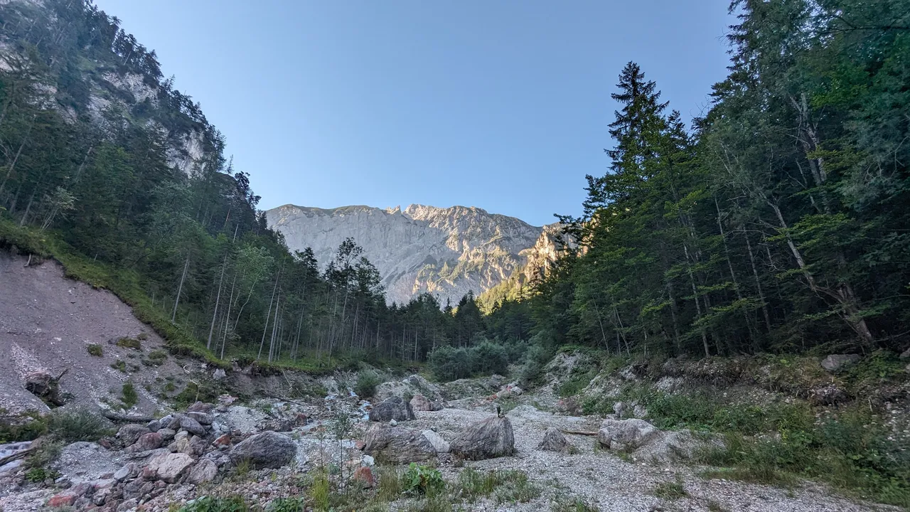
I drove to Großreifling early in the morning and followed the road to Erb as far as Hackenbachschmiede, where I turned into a small valley. At the end of the small road, right next to the Tamischbach stream, a car park was located for me. From the streambed, I had a good view of the mountain I wanted to conquer today.
Ennstaler Hütte#
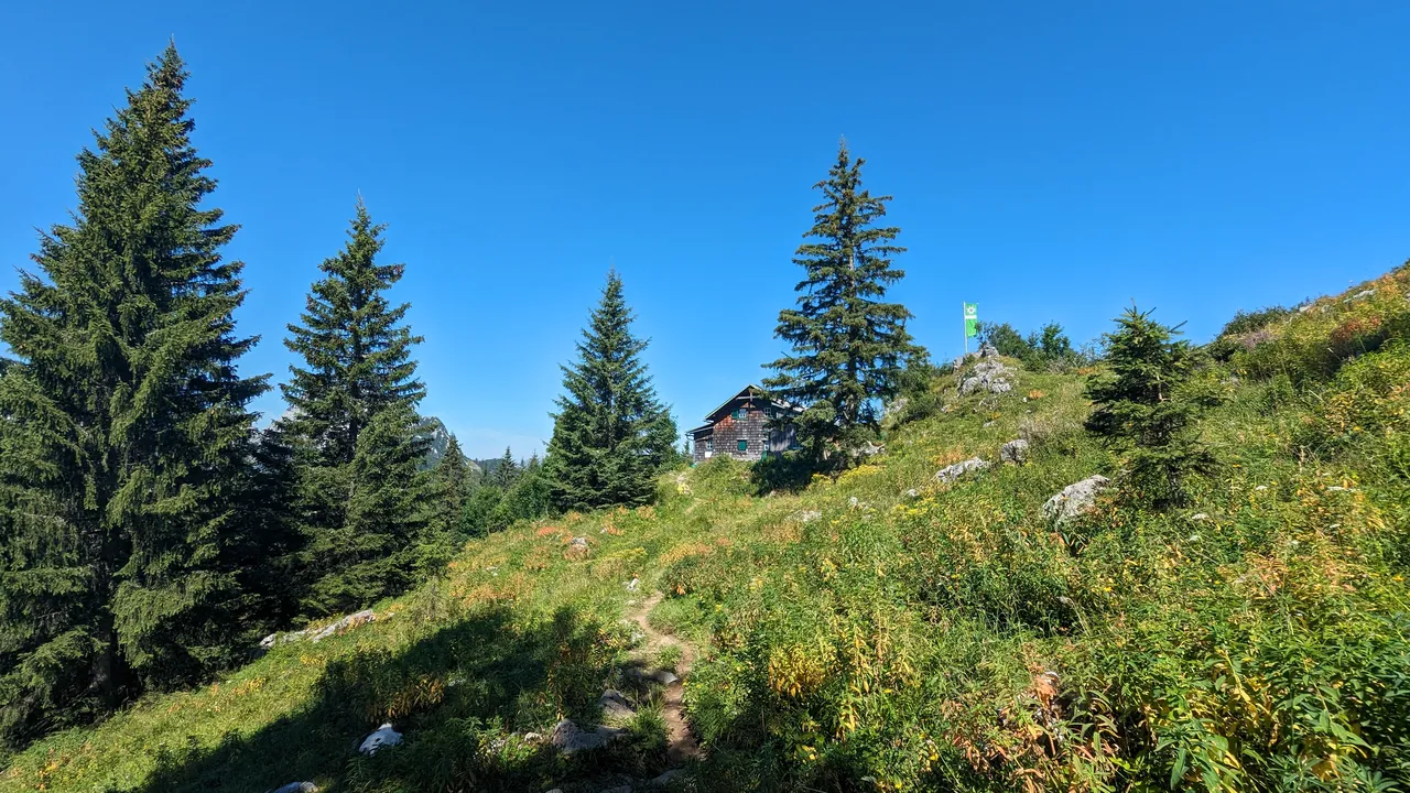
In the morning, the whole valley was still in the shadow of the mountain. The temperature was cool, but as I set off, I quickly warmed up. The path led up through the forest. It became steeper just before the saddle. I really enjoyed it, especially the view of the Alpine foothills. The path ended in front of the Ennstaler Hütte, the oldest hut in the Gesäuse.
There I was able to get my first glimpse of the magnificent Gesäuse National Park. Several hiking trails lead away from the hut, and I took the one to the summit of the Tamischbachturm.
To the Tamischbachturm#
The ascent was quite easy, but now I was exposed to the sun, especially when I crossed the tree line. Once at the top, I enjoyed a wonderful 360° view of the Gesäuse and the Alpine foothills. There were already a few people on the summit. I sat down on a stone and took a short break.
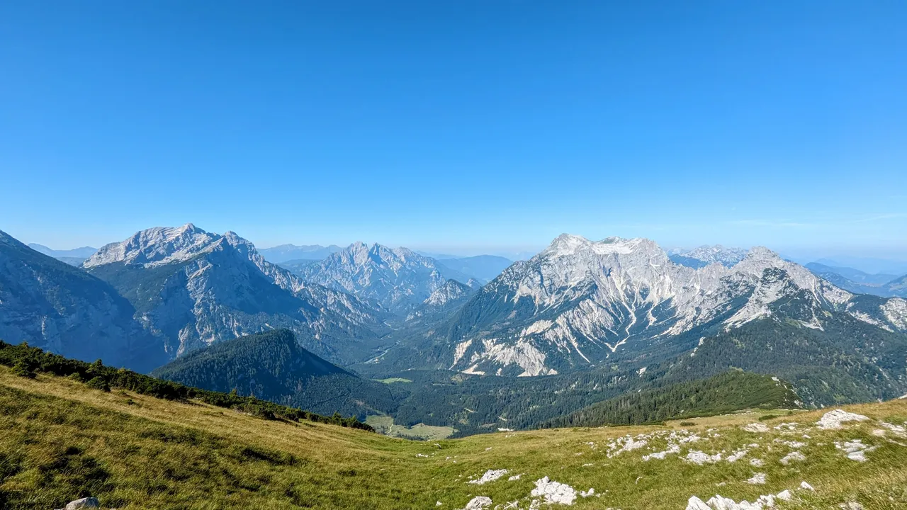
View from left to right: Hochtor and Großer Ödstein, Admonter Reichenstein and Sparafeld, Großer Buchstein with St. Gallener Spitze and Kleiner Buchstein. Between the St. Gallener Spitze und Kleiner Buchstein one can spot the Haller Mauern.
Descending, I reached the Ennstaler Hütte again. I decided not to refill my water, a mistake I later regretted. I continued via the deserted Eggeralm to my second summit, the Tieflimauer.
The legend of the Luckerte Mauer#
The alp was lush with flowers and grass. I noticed a rather curious sight. There was a large hole in a stone wall, the Luckerte Mauer. There is a legend about this stone formation.
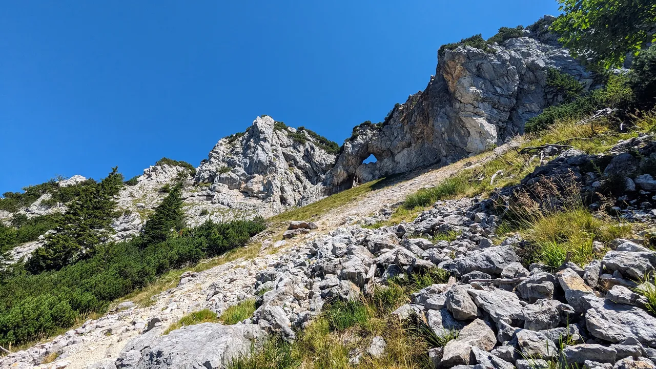
Allegedly, the devil crashed through the stone wall and left this huge hole. He made a bet with the priest of Johnsbach that he could bring him a stone from a distant mountain before the priest could finish his mass. Shortly before his return, the devil became tired. He was afraid he would be too late, so he took the shortest route, straight through the stone wall. But that didn’t help him. Shortly before he arrived in Johnsbach, he heard the church bells ringing for the end of mass.
When I reached the turn-off to the summit of the Tieflimauer, I decided not to go up. I was already pretty exhausted and had the feeling that the ascent and descent of around 300 metres in altitude on a difficult path might be too much for me.
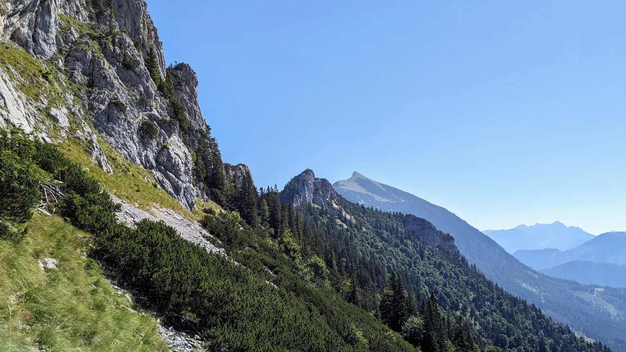
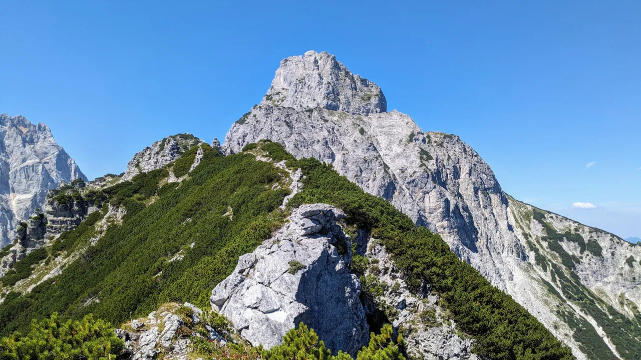
So I continued along the ridge between Tieflimauer and Kleinem Buchstein. The view was spectacular, especially of the Buchstein massif, but the hike was strenuous and sapped my strength.
Slowly over the Schneckenmäuler (snail’s mouth)#
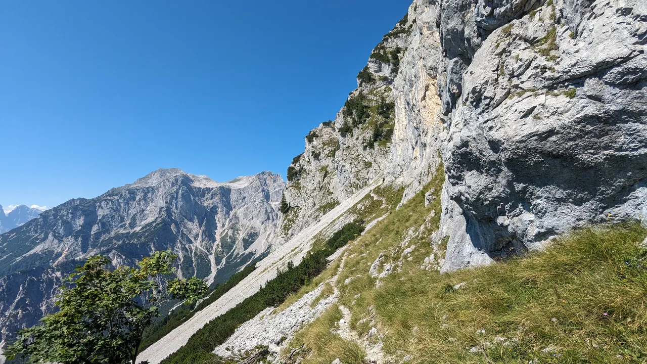
It was a difficult section and I had to be careful not to slip in the rubble below the Tieflimauer and fall into the valley. The path requires surefootedness. Fortunately, it was well maintained and well marked, otherwise it would have been difficult to find in the rubble. I didn’t enjoy walking on this brittle surface and it took me longer than I thought.
After bypassing the Tieflimauer, I found myself on the ridge of the Schneckenmäuler. I had to use my hands a few times to climb up and down. The path was exposed in places as it ran between two steep rocky slopes. But here the view was breathtaking. I was relieved when I left the rubble behind me, bypassed the steep rock face of the Kleiner Buchstein and was able to descend again.
The descent#
By this point I was pretty exhausted. I had run out of water during the ridge walk and the sun was burning mercilessly. My legs were also cramping, which had caused me some problems on the previous short climb. I don’t know why it happened back then. I thought the lack of water and food contributed to my exhaustion but a few days afterwards I learned that I had contracted Covid.
Unlike my previous hikes, I didn’t eat much this time. I didn’t really feel hungry. I was now eating my granola bars in short bursts, hoping it would re-energize me. But it was difficult to get them down without water.
I was so relieved when I finally heard water splashing. A few streams flowed down the mountainside. And when I had to cross one, I immediately took the opportunity to fill up my water bottles and drink 1 litre of it. My feet and shoes also got wet from the crossing. It was a nice feeling to dip my feet into the water.
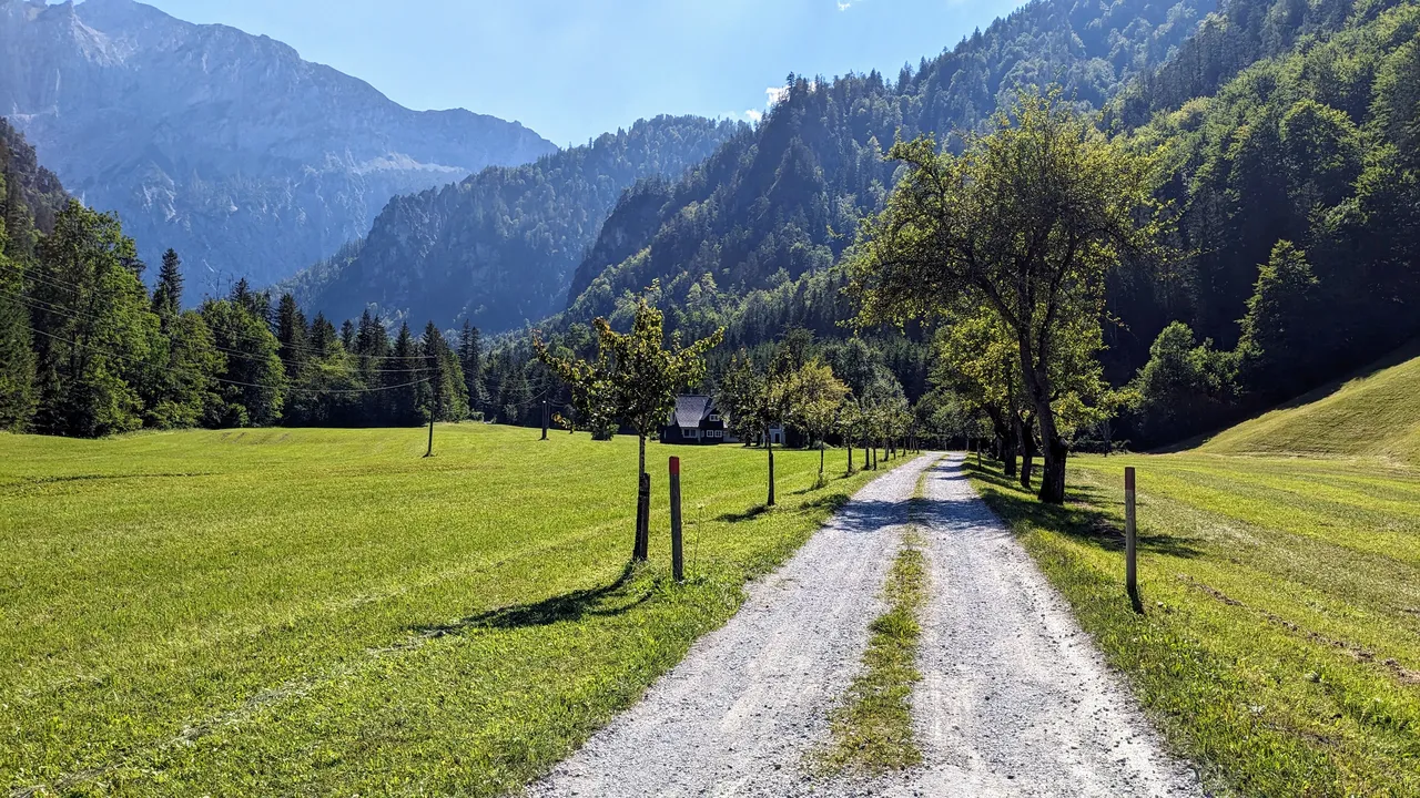
The last part of the hike was along forest paths and roads. Some fruit trees lined the road and there were a few small farmhouses. It looked beautiful and very secluded from the rest of the world. Back at my car park, I dipped my feet into the cold water of the Tamischbach stream again. It was such a relief after this long and strenuous hike.