
On a beautiful, sunny Sunday morning, I drive to Sarmingstein to tackle a short trail run. The Danube is still a little brown from the heavy rain showers of the last few days, but the sun is already shining beautifully. I park my bike at the local inn, a few Danube cycle path cyclists are still having breakfast, and set off.
Predigstuhl climb#
Here, the Sarmingbach cuts a deep furrow into the granite of the Mühlviertel, which slopes steeply down to the Danube. I initially follow the sloping road through the village. The modern main road to Waldhausen, on the other hand, winds its way up the slope in serpentines. You can take either route if you are looking for the path up to the Predigtstuhl.
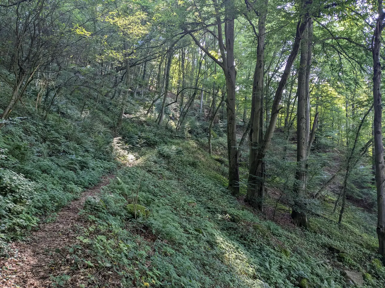
This trail leads me through a beautiful deciduous forest with plenty of low vegetation, but the path is easy to walk on. I cross a small spring. The birds are chirping. The pleasant forest atmosphere is only occasionally disturbed by noisy motorbikes speeding along the Danube embankment road. This picturesque stretch of the Danube is extremely popular with motorbike and sports car drivers.
Nöchlinger Plateau#
At the Bauerngruber farm, the forest thins out and offers a view of the Danube towards Ybbs. Here I also have the choice of shortening the route and going directly to the Predigtstuhl, or continuing on my planned route to Nöchling. Of course, I continue walking. I reach a short section of forest where I cross a small, nameless stream with the help of a slightly mouldy bridge.
The stream is also the border between Upper Austria and Lower Austria. The forest path soon comes to an end and I run along a tarmac road via the Kienberg and Oed hamlets to Nöchling.
I don’t stay long in Nöchling. I don’t even have time to visit the local church. The surrounding area is characterized by rolling hills, with a few woods here and there. I walk along the Hubertusweg and pass several farmsteads until I reach the Gloxwald. The lush meadows on this high plateau are busily cultivated by the surrounding farmers. The grass is mown and dried into hay to provide plenty of fodder for the winter.
Gloxwald#
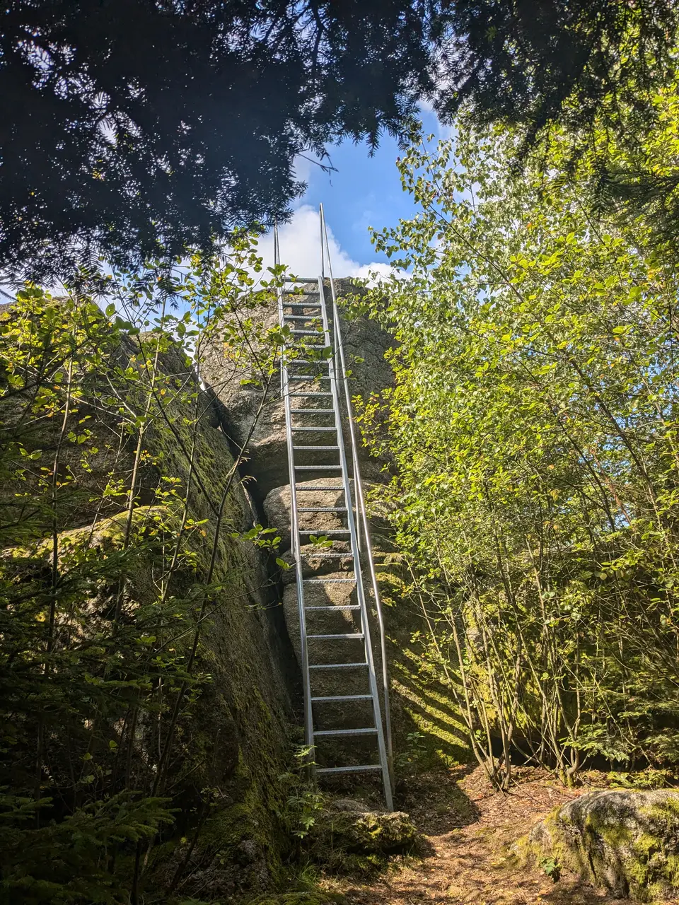
I now run slightly uphill on a forest road to the first interesting sight on this tour: the Einsiedlerstein. A little way off the forest road, a small path leads to it. You can climb the stone using a ladder. However, the view is less marvellous. Trees obscure it. But there is something else on top the stone. Small man-made sacrificial bowls have been carved into the stone.
The path down to Gloxwald settlement is overgrown with wild raspberry bushes. If you don’t want to fight your way through this, I recommend returning to the forest road. The forest road is a fairly brisk walk down to the Gloxwald quarries. The quarry, where granite was once mined for paving stones and gravestones, has been closed since the 1970s. Since then, rainwater has collected and formed small fishponds and biotopes.
The nearby settlement is of more recent origin and was only built towards the end of the 19th century as a workers’ settlement for the quarry. I quickly pass through and make my way to the most prominent viewpoint on the tour.
Predigstuhl#
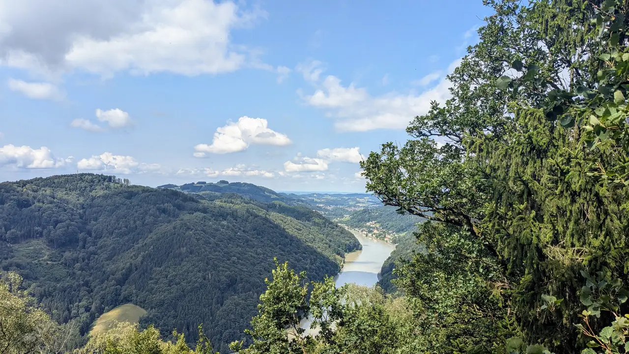
A narrow path leads through the forest to several rocky outcrops that offer a wonderful view of the Danube valley. You can see deep into the Machland, a fertile plain where vegetables are grown. I can see the castles of Grein, Clam and Kreuzen in the distance. The place is popular. I meet quite a few hikers in this small wooded area, whereas the rest of the route is rather quiet.
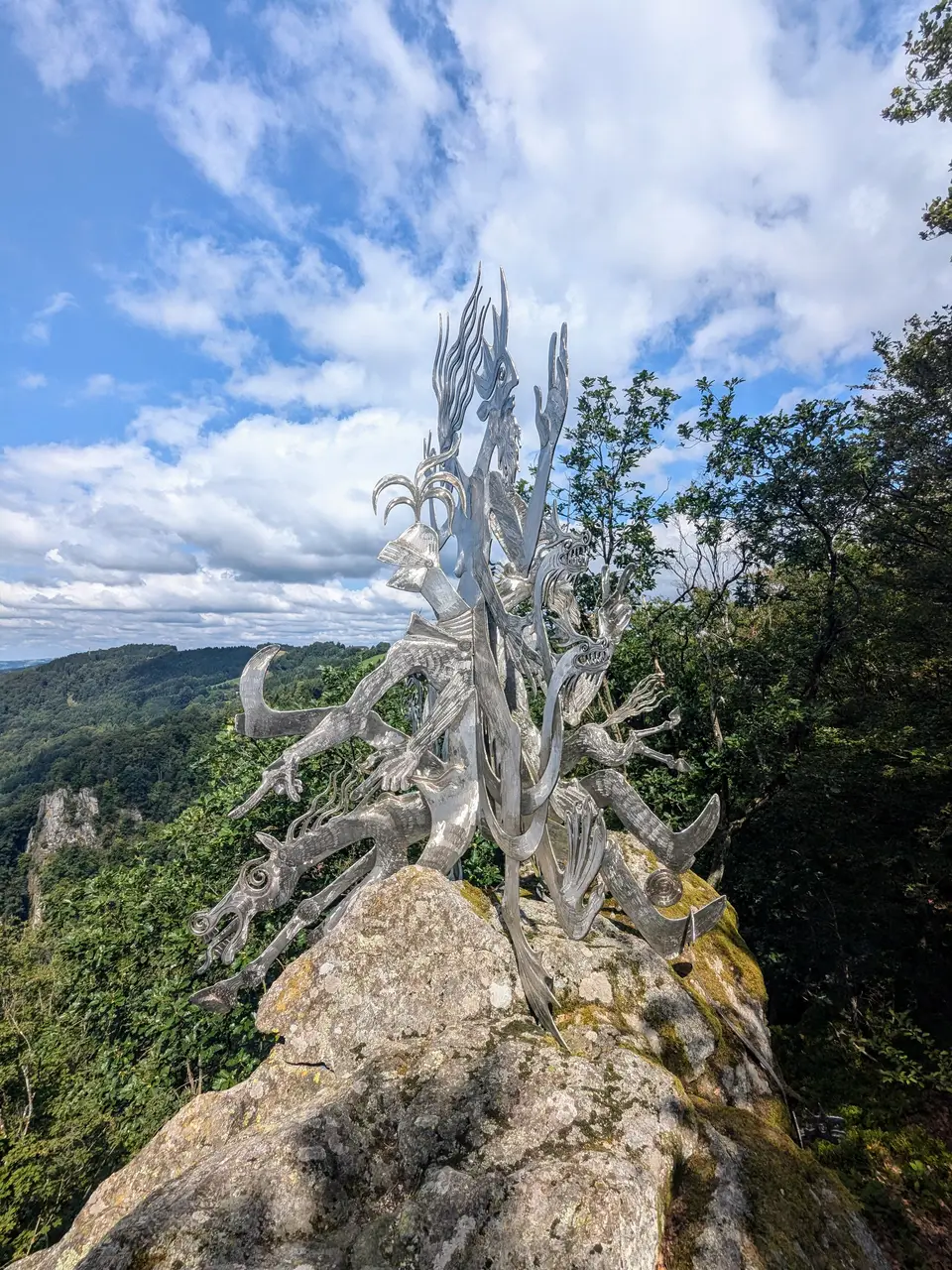
The metal sculpture Felsenreiter by the Mostviertel artist Miguel Horn stands on the last rocky outcrop. The sculpture represents four legendary figures of the Strudengau: a robber baron who plunges down into the Danube; at his side, the Danube prince with the Danube nymph, who rule over the Danube and the swirls; and the grey monk.
Sarmingbach#
After visiting the Predigtstuhl, I return, walk slightly downhill on a wide forest road and then on a road down to the Sarmingbach stream. There are a number of ruins nearby, such as the Säbnich and Sarmingstein ruins.
I had actually planned to climb up to the Sarmingstein ruin, but the path is heavily overgrown, so I abandon my plan. I end up walking along the Sarmingbach stream, which is soon bundled into a canal so that its energy can be used to generate electricity at the Sarmingstein small hydroelectric power station. The power station supplies electricity for around 1000 households in the surrounding area. Once I reach the bottom of Sarmingstein, I visit the old toll tower. It is easy to visit via a short path above the village.
An exciting tour, but one that is best undertaken in autumn when the deciduous trees are changing colour. Despite the Danube, it is too hot in summer and the lush vegetation sometimes makes progress difficult.